Hiking Along Hadrian’s Wall
The United Kingdom has dozens of great long-distance hiking routes. From easy country strolls to rugged treks across the Scottish Highlands, they offer it all. One of the best things about hiking in the UK for the history lover is the number of historic and archaeological sites you can see along the way. Perhaps the best route for this is the Hadrian’s Wall Path, which runs 84 miles along the entire length of the wall.
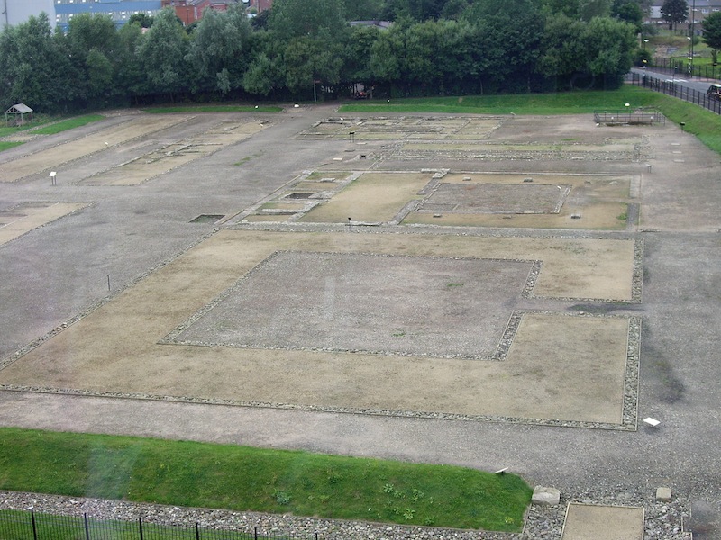
When I hiked the path, I decided to start at Newcastle upon Tyne and walk the entire way west to Bowness-on-Solway, on Solway Firth, thus crossing the country and seeing every bit of the wall. One advantage to starting in Newcastle is that you get to see the Roman fort of Segedunum to give you a taste of what’s to come. Once you get out of the urban sprawl, you have nothing but nature until Carlisle.
Hadrian’s Wall was more than just a simple wall. There were several forts spaced out along its length, as well as fortified gates called “mile forts” every Roman mile. To the south of the wall, on the Roman side, was a deep ditch with a double rampart called the Vallum. Archaeologists have looked at this strange feature and theorize that Hadrian’s Wall wasn’t just for defending the province of Britannia from Picts and other tribes, but also to control and tax trade going north and south.
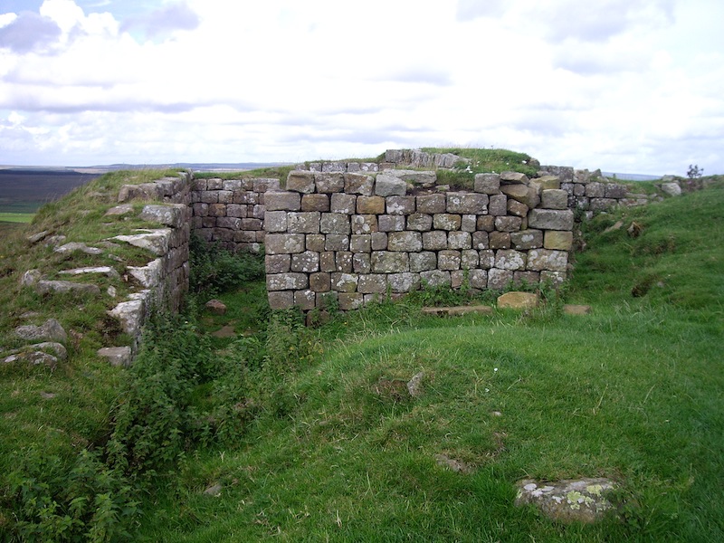
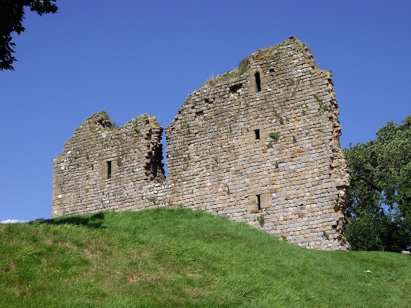
The best-preserved parts of the wall are at the center of the trail, where the population has always been sparse. At times, the wall is preserved several courses high and you can spot Roman stone reused in local farms, Saxon forts, churches, and pele towers, which were small keeps or watchtowers built along the border region, usually to protect a single noble family and its retainers. At times, you can see the remains of Roman temples.
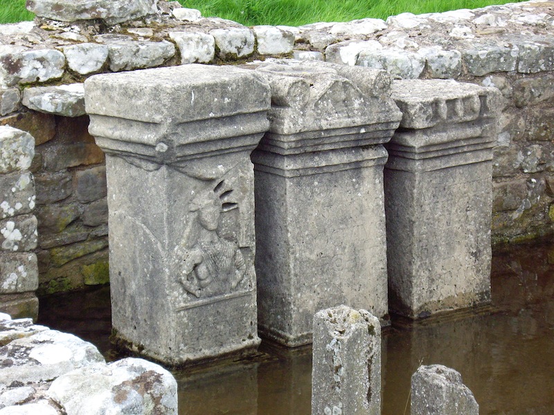
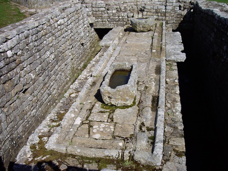
The Roman forts make for some of the best visits while walking the wall. One well-preserved example is Housesteads, which has an interesting little museum and several exposed buildings, including a large latrine. A sign informed me that the Romans used sponges soaked in vinegar to clean their backsides. I’m not sure what I’m going to do with this knowledge, but it’s interesting.
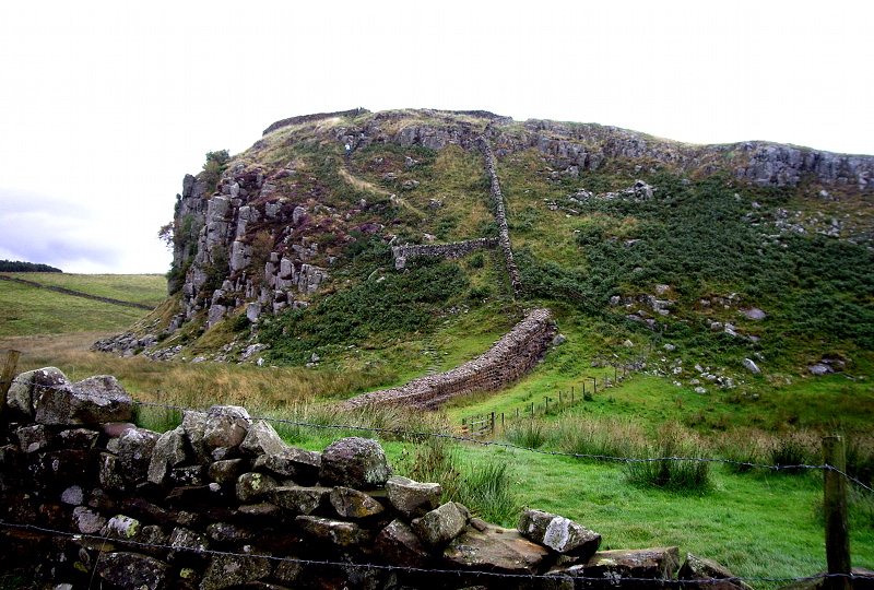
The wall continues through a landscape that gets ever bleaker and rougher. At times, it climbs up and over steep crags that offer a sweeping view of the countryside. When hiking in the UK, it’s best to bring an Ordnance Survey map. These detailed maps are the gold standard of cartography and show every house, ruin, and country lane. It would take some work to get lost with one of them and they’re hugely informative about the area. I spent many long rest breaks sitting on top of the crags, spotting landmarks both ancient and modern with the help of my OS map.
Again and again on this hike, I was impressed by how Hadrian’s Wall has become part of the natural and historic fabric of the landscape. Some of the mile forts are now farmer’s gates, while Roman stone can be seen in many buildings. Ancient altars bear offerings of modern coins and flowers.
Hiking the Hadrian’s Wall Path is fun and not too challenging. My longest day was 15.5 miles. While there are plenty of lonely stretches in the middle, there are still enough rural pubs with rooms along the way that you don’t have to camp if you don’t want to. Book ahead, though. The fifth day out of Newcastle will get you to Carlisle, which is worth staying for a couple of days to see the imposing castle, excellent museum, and other historic attractions. You’re not done, though! There’s still 15 miles more to go to make it to Solway Firth, site of the Roman fort of Maia (now disappeared) and the end of the hike. Once you’re done, you can hop on a bus or taxi back to Carlisle to see more of the sights.
So if you’re up for a historic hike like no other, try out the Hadrian’s Wall Path.
Sean McLachlan is a freelance travel and history writer. He is the author of the historical fantasy novel A Fine Likeness, set in Civil War Missouri, and the post-apocalyptic thriller Radio Hope. His historical fantasy novella The Quintessence of Absence, was published by Black Gate. Find out more about him on his blog and Amazon author’s page.
All photos copyright Sean McLachlan.
One might want to read Joseph O’Neill’s LAND UNDER ENGLAND before or after walking the Wall. The narrator discovers an opening along Hadrian’s Wall that leads to s subterranean realm. Tolkien on the novel here:
http://users.bestweb.net/~jfgm/Letters/Letter%2026.htm